I have lived in Yorba Linda for over 40 years. I grew up here. I raised my family here. And I have hiked, biked, and walked almost every trail that touches this city.
Last March, I took a couple relocating from Seattle on a neighborhood tour. They had narrowed their search to Travis Ranch and Vista Del Verde but could not decide. So instead of showing them another kitchen, I drove them to the Rim Crest trailhead. We walked South Ridge Trail for about 20 minutes until we hit the first overlook. The husband looked south across the whole Orange County basin, turned to his wife, and said, "This is right behind our house?" They bought in Vista Del Verde three weeks later. Their back gate opens to a connector trail that puts them on the South Ridge in under 10 minutes.
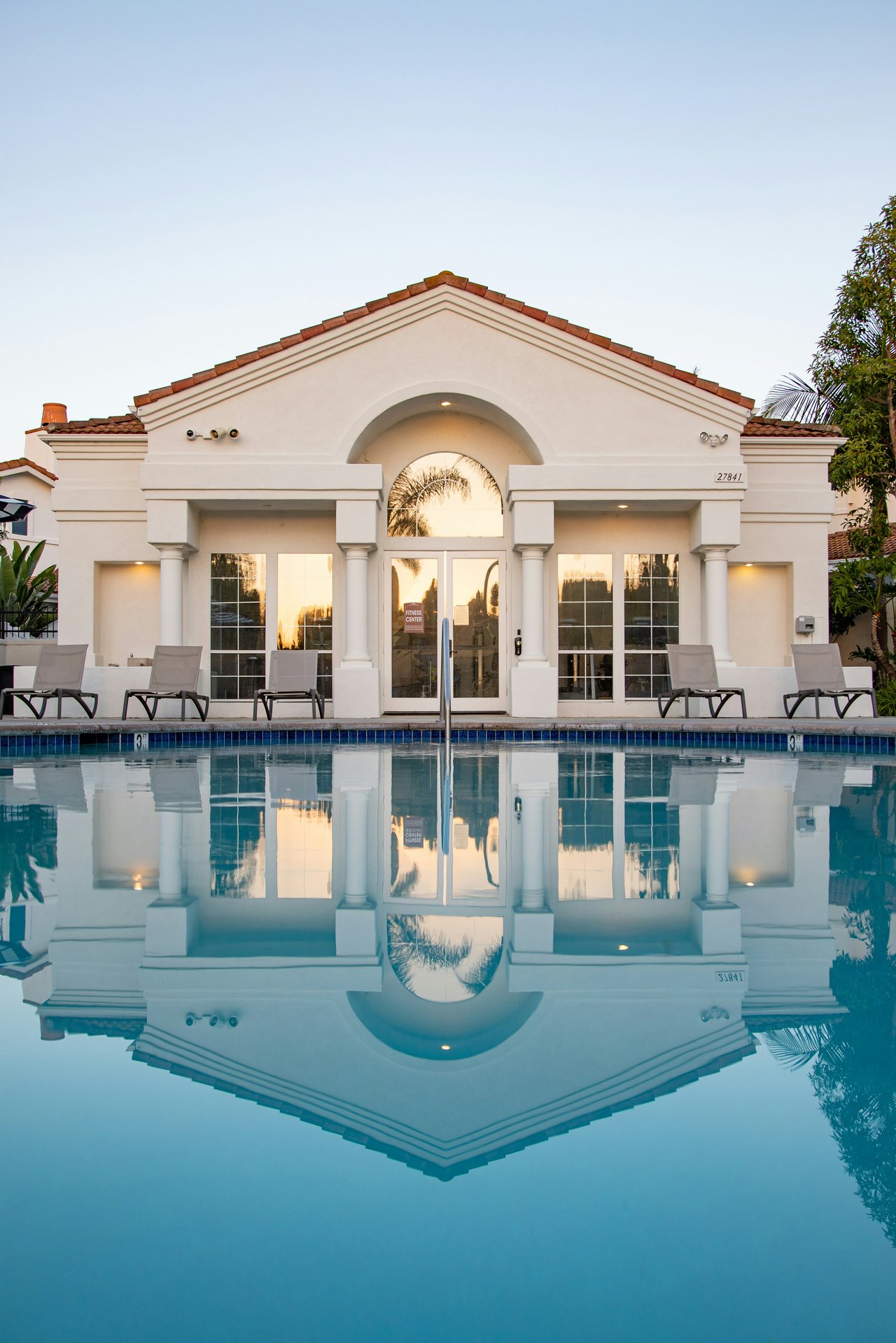
That is the kind of thing you cannot understand from a listing photo. Trail access is one of Yorba Linda's most valuable features, and it is invisible until someone shows it to you.
This post is the local's version. Which trails I actually use, which trailheads save you time and money, which routes work for families versus serious hikers, what each season looks like, and what you absolutely need to know about closures that will ruin your Saturday if you do not check before you drive.
Why Yorba Linda Has Some of the Best Trail Access in Orange County
Yorba Linda sits on the southern border of Chino Hills State Park, a 14,102-acre open space preserve with over 90 miles of trails spanning three counties (Orange, San Bernardino, and Riverside). The park was created in part to prevent Southern California housing development from closing off a critical wildlife corridor between the Santa Ana Mountains and the Puente Hills. Source: California State Parks, Recreation page.
The result is that Yorba Linda homeowners have a 14,000-acre backyard.
On top of the state park, the City of Yorba Linda maintains its own system of over 100 miles of trails coordinated for hikers, bikers, and equestrians. These city trails link neighborhoods to Chino Hills State Park, Carbon Canyon Regional Park, the Orange County Santa Ana River Trail, and Yorba Regional Park. The city's Master Plan of Trails was updated in 2024 to strengthen connections between neighborhoods and open space. Source: City of Yorba Linda Trails page.
Three staging areas in Yorba Linda provide direct access to the state park. The Casino Ridge and Quarter Horse staging areas have direct routes in. The Gun Club Road Linear Park connects indirectly. And the Rim Crest Drive trailhead puts you on the South Ridge Trail within 100 feet of your car.
I will break this down by entrance because that is how you should actually think about it. Where you start determines what trails you hit, how long your hike is, and whether you pay for parking.
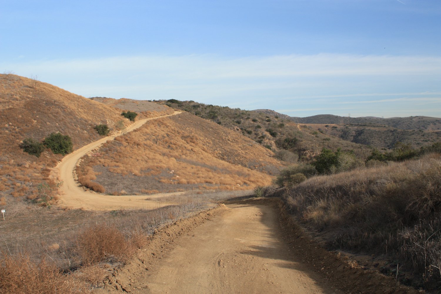
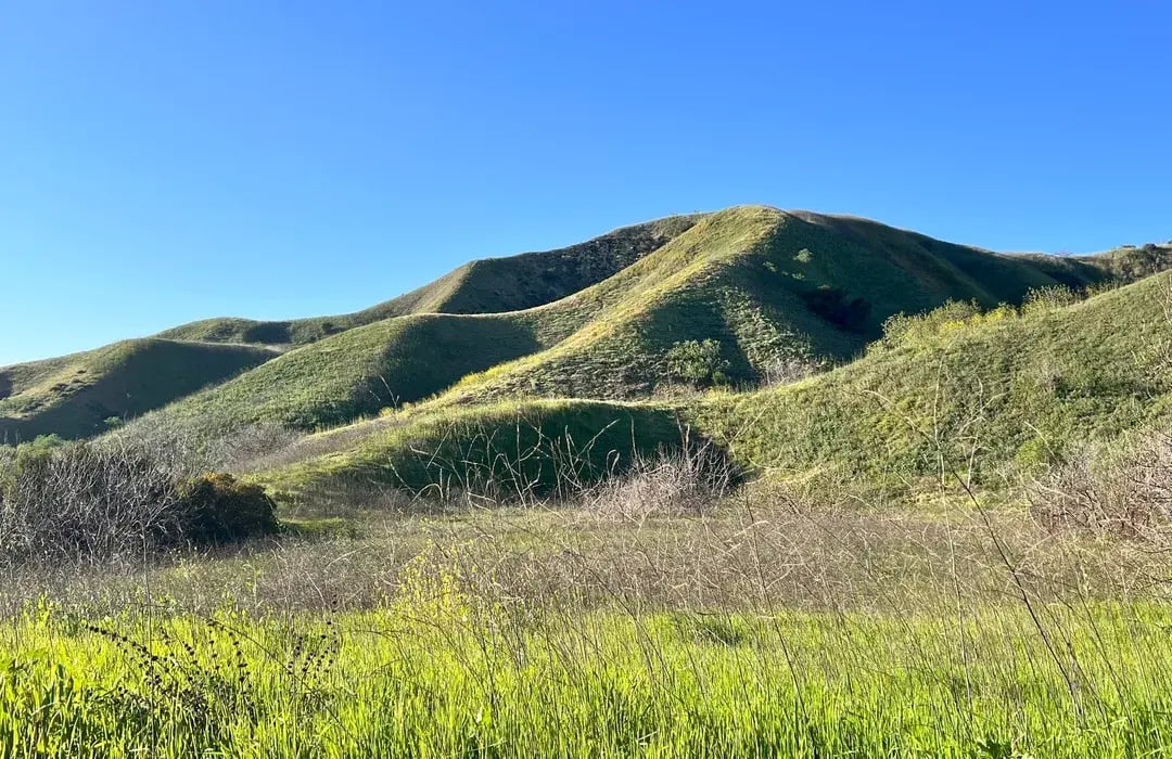
This is the kind of open ridgeline terrain you will find on some of the best hiking trails near Yorba Linda, especially around San Juan Hill and South Ridge Trail.
What the Trails Look Like Season by Season
Before I get into the specific routes, let me tell you something most trail guides leave out: Chino Hills State Park looks like four completely different parks depending on what month you visit. I have had buyer clients visit for a neighborhood tour in August, see brown hills, and write Yorba Linda off. Then I send them a photo from the same ridgeline in March and they call me back. Understanding the seasonal cycle is the difference between falling in love with this park and wondering what the fuss is about.
Late February through March: The Green-Up. After winter rains, the hills turn an almost impossibly bright green. If you have only seen Chino Hills in summer, you will not recognize it. The grass is thick, the air is cool, and the trails are soft underfoot. Creek beds in Telegraph Canyon actually have water running. I have a favorite rest spot about two miles in from the Carbon Canyon side, under a cluster of oaks where Telegraph Creek pools up in spring. You can sit on a flat rock, eat a sandwich, and hear nothing except acorn woodpeckers and running water. It is hard to believe you are 15 minutes from the 91 Freeway. This is my favorite time to hike South Ridge Trail because the rolling green hills look like something out of Ireland, not suburban Orange County. The catch: rain closures are frequent during this period. Check the park website before every single visit. Budget for one or two ruined weekends per month.
April through early May: Wildflower Season. This is when the hills turn yellow. Black mustard and wild radish blanket the hillsides in vivid gold. In a good year, the mustard grows up to six feet tall and you are literally walking through walls of yellow flowers on the narrower sections of Telegraph Canyon Trail. California poppies, Canterbury bells, arroyo lupine, and redmaids appear in smaller pockets, especially along Bane Canyon Road and near the Discovery Center. A true "superbloom" only happens every few years after an unusually wet winter, but even in a dry year, there is enough color to make a spring hike feel special. Picking or disturbing wildflowers is prohibited. The park gets much more crowded during bloom season, especially on weekends. If you want the wildflower experience without the crowds, go on a Tuesday or Wednesday morning. I take my camera out during wildflower season specifically on overcast mornings. The diffused light makes the yellows and oranges pop without the harsh shadows you get at midday. Source: California State Parks, Spring Wildflowers page.
Late May through September: The Dry Season. The green fades to gold, then to brown. The hills look like the stereotypical Southern California scenery you see in movies. Temperatures regularly hit 85 to 95 degrees on the ridgelines, and the fire roads have zero shade. This is when early morning starts become mandatory, not optional. I do not hike after 10 AM in July and August, and I know regulars who start at 5:30 AM to finish before the heat sets in. Rattlesnakes are most active during warm months, so watch where you step and where you sit. I have seen two rattlesnakes on South Ridge Trail in 40 years, both times in late June, both times sunning on the edge of the trail where the dirt meets the dry grass. They were not aggressive, but they were hard to spot. The upside of summer? The trails are much less crowded because casual hikers stay away from the heat. If you go early, you can have entire sections of the park to yourself. I do most of my summer hiking on the Telegraph Canyon trail because it follows a riparian area with actual shade from sycamores and willows.
October through January: The Quiet Season. The park stays brown and dry until the first significant rains arrive, usually in November or December. Once the rain starts, the 48-hour closure cycle begins (more on that below). But between rain events, late fall and early winter are some of the best hiking conditions of the year: cool temperatures, low humidity, clear views, and very few other people. On a clear December morning, you can see from the San Gabriel Mountains to Catalina Island from the San Juan Hill summit. This is also when Red Flag Warnings can close the park with little notice, usually coinciding with Santa Ana wind events between October and December. If you are relocating from a place with real winter, this is the season that will make you feel like you cheated the weather system. Sixty-five degrees, blue sky, panoramic views, and a light jacket is all you need.
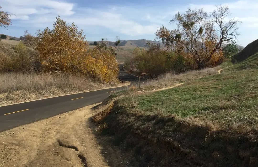
When the ridgeline trails are closed for rain, locals still walk or bike sections of Bane Canyon Road to get their outdoor fix.
Entrance 1: Rim Crest Drive Trailhead (Yorba Linda)
This is the entrance I use the most, and it is the one most Yorba Linda residents should start with.
Location: Rim Crest Drive at Blue Gum Drive in Yorba Linda, just north of Yorba Linda High School.
Parking: Free street parking. No entrance fee. This is a residential neighborhood, so be respectful. Do not block driveways and note that parking is prohibited from 7 PM to 8 AM on surrounding streets.
What you access: South Ridge Trail, Easy Street Trail, and from there the entire western section of Chino Hills State Park including Telegraph Canyon, Little Canyon, Bovinian Delight, Diemer Trail, and San Juan Hill.
Restrooms/Water: No facilities at this trailhead. Bring everything you need.
From the Rim Crest trailhead, you are immediately at a four-way junction. To the right (east), South Ridge Trail climbs up along the ridgeline toward San Juan Hill. Straight ahead, Easy Street Trail drops down into Telegraph Canyon. To the left (west), South Ridge Trail follows the ridge in the other direction toward Diemer Trail and Glider Point.
Here are the routes I recommend from Rim Crest, organized from easiest to hardest.
Little Canyon Loop (Moderate, about 4.5 miles, roughly 400 feet of elevation gain)
This is my go-to recommendation for families and hikers who want a real workout without an all-day commitment. From the trailhead, take South Ridge Trail east (uphill) for about a mile. At the first signed junction on your left, drop down Little Canyon Trail. It is a narrow single-track that descends steeply for about a third of a mile to Telegraph Canyon Trail. Turn right (west) on Telegraph Canyon and follow it back toward Easy Street Trail, which climbs south back up to the Rim Crest trailhead. Total loop takes most people about 90 minutes to two hours.
Little Canyon Trail itself is the highlight. It is one of the few trails in the park with actual single-track terrain, not just a wide fire road. You will see coastal sage scrub, lemonade berry, holly-leaf cherry, and sometimes rabbits and coyotes. The descent is steep enough that you want proper shoes, not sandals. This trail earned a 4.6-star rating from over 750 community reviews on AllTrails, making it one of the most popular loops in the park.
I ran this loop with my son when he was training for cross country at Yorba Linda High School. It is a perfect training route because the terrain changes every half mile: ridgeline climb, steep descent, flat canyon, then a punchy uphill back to the car.
Shaded sections like this in Telegraph Canyon are a lifesaver during summer hikes in Chino Hills State Park.
South Ridge to Bovinian Delight Loop (Moderate, about 5 miles, roughly 700 feet of elevation gain)
From Rim Crest, take South Ridge Trail east for about 1.75 miles, then turn north (left) on Bovinian Delight Trail. This drops you down into Telegraph Canyon where you head west on Telegraph Canyon Road, then climb back up via Easy Street Trail to Rim Crest. This loop gives you ridgeline views on the way out and shaded canyon walking on the way back. Budget about 2 to 2.5 hours.
Bovinian Delight is where the trail name matches the experience. The descent from the ridge into Telegraph Canyon is steep but scenic, dropping through grassland into a riparian zone with a creek bed and actual trees. In spring, the transition from open hilltop to shaded canyon floor feels like walking into a different park.
San Juan Hill via South Ridge Trail (Moderate to Hard, 6.1 miles out and back, 1,046 feet of elevation gain)
This is the crown jewel. San Juan Hill stands at 1,781 feet and is the highest point in all of Chino Hills State Park. The summit has a concrete monument dated 1896 (placed by the U.S. Coast and Geodetic Survey two years before Teddy Roosevelt's famous charge up a different San Juan Hill in Cuba). There is also a USGS marker noting the boundary between Orange and San Bernardino Counties. The 360-degree panoramic view takes in the San Gabriel Mountains, the LA Basin, the rolling hills of the park itself, and on clear winter mornings, the Pacific Ocean. Source: AllTrails, San Juan Hill via South Ridge Trail.
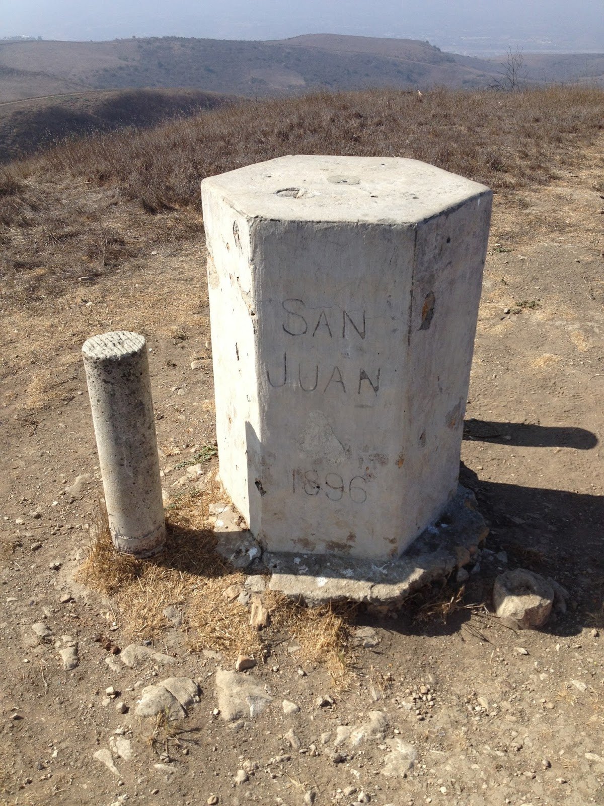
The 1896 summit monument at San Juan Hill, the highest point in Chino Hills State Park.
The route is straightforward: from Rim Crest, take South Ridge Trail east the entire way. The trail is a wide, well-maintained fire road that follows the ridgeline. It undulates with several steep climbs and descents. About 2.9 miles in, look for a short single-track spur on your right that leads to the actual summit. The whole out-and-back takes most hikers 3 to 3.5 hours. Source: Modern Hiker, San Juan Hill.
Fair warning: There is zero shade on this route. None. I bring at least 2.5 liters of water even on cool mornings. Wear a hat and sunscreen. Start before 8 AM from May through October. I have personally seen people sitting on the trail unable to continue by 10 AM in summer because they underestimated the sun exposure on a fully exposed ridgeline for over 3 miles.
San Juan Hill Full Loop (Hard, 8.2 miles, 1,210 feet of elevation gain)
For experienced hikers who want the full experience, this loop takes South Ridge Trail east to San Juan Hill, continues to Bovinian Delight Trail, drops into Telegraph Canyon, follows Telegraph west, and returns via Easy Street Trail. You hit the summit, get the canyon scenery, and do not repeat any trail. Budget 3.5 to 4 hours. Source: AllTrails, San Juan Hill loop.
Entrance 2: Quarter Horse Drive Trailhead (Yorba Linda)
Location: Quarter Horse Drive, off Fairmont Blvd in Yorba Linda. Fairmont Blvd intersects Yorba Linda Blvd between Imperial Highway and the 91 Freeway.
Parking: Free. This is a 3.5-acre staging area with trailer parking, designed for equestrians and hikers. Source: City of Yorba Linda, Quarter Horse Staging Area.
What you access: Fairmont Staging Trail, which climbs north on a wide dirt path and connects to South Ridge Trail inside Chino Hills State Park. From there you can access the same network as Rim Crest (Telegraph Canyon, San Juan Hill, etc.) but from a different angle.
Best for: Equestrians, families who want a designated parking area rather than street parking, and anyone who wants a gradual warm-up climb before hitting the main trails.
The Fairmont Staging Trail is exposed with no shade, so the same sun warnings apply. Bring water, wear a hat, start early in warm months. I send clients who are looking at homes near Fairmont Blvd to this trailhead specifically because it is a 3-minute drive from the neighborhoods between Yorba Linda Blvd and the hills. If trail proximity matters to your family, the homes along Fairmont between Via de la Roca and Quarter Horse Drive are as close as it gets.
Entrance 3: Casino Ridge Staging Area (Yorba Linda)
Location: Casino Ridge area in northern Yorba Linda, accessible from Hidden Hills Road.
Parking: Free staging area.
What you access: A more direct route to the eastern portions of the state park, including Bobcat Ridge Trail, which traverses through the Water Canyon Natural Preserve. This is a more remote, less-trafficked section of the park. Source: California State Parks, Recreation page.
Best for: Hikers and equestrians who want solitude. This entrance sees far less traffic than Rim Crest or Quarter Horse. If you have been hiking the western trails for years and want something different, Casino Ridge opens up a whole new section of the park.
A client who bought in the Hidden Hills area of Yorba Linda told me she hikes from her back gate through the Casino Ridge connector into the park three mornings a week before work. No driving, no parking, no crowds. Just walks out the back gate and she is on the trail. That is the kind of lifestyle detail that does not show up on a real estate listing.
Entrance 4: Carbon Canyon Discovery Center (Brea)
Location: 4500 Carbon Canyon Road (State Route 142), Brea, CA 92823.
Parking: $10 per vehicle. Seniors 62 and older pay $9. Walking traffic enters free. Cash, check, or credit card accepted. Source: California State Parks, Chino Hills page.
Hours: 8 AM to 5 PM (October through first Sunday in April). 8 AM to 7 PM (April through September). Source: City of Chino Hills, State Park page.
What you access: Telegraph Canyon Trail (the primary east-west corridor through the park), North Ridge Trail, the Discovery Center with educational exhibits, and connections to the full trail network. The Discovery Center also has its own fully accessible Discovery Trail, a short interpretive loop that walks you through five distinct habitats found in the park: coastal sage scrub, woodland, grassland, riparian, and chaparral. It has interpretive signs, a native flower garden, and is flat enough for strollers and wheelchairs. Open weekends 10 AM to 2 PM during winter. If you have a kid who is curious about plants and animals, this is worth the stop before you hit the longer trails.
Best for: Longer through-hikes of Telegraph Canyon, access to the North Ridge (note partial closure below), and families who want restrooms, drinking water, and a staffed visitor center. This entrance is technically in Brea, right at the border with Yorba Linda.
The local parking hack: Park in Carbon Canyon Regional Park next door for $3 on weekdays or $5 on weekends instead of paying $10 at the Discovery Center. The regional park is adjacent, trails connect, and you save half the cost. Carbon Canyon Regional Park is also where you will find Orange County's only grove of coastal redwood trees. Source: OC Parks, Carbon Canyon Regional Park.

Here are the rolling hills visible along Telegraph Canyon Trail during the spring green-up in Chino Hills State Park.
What Is Telegraph Canyon Trail and Why Does It Matter?
Telegraph Canyon Trail is the spine of Chino Hills State Park. It runs east to west from the Rolling M Ranch area all the way to the Discovery Center on Carbon Canyon Road. It follows the route of an old telegraph line from the late 1800s. The trail is roughly 11.9 miles end to end with about 856 feet of elevation gain. Source: AllTrails, Telegraph Canyon Road.
Most of it is a wide, well-maintained fire road. The first several miles from the Carbon Canyon end follow a riparian area with sycamores, willows, and some oak trees. You will see red-tailed hawks, mule deer (especially at dawn and dusk), ground squirrels, and occasionally coyotes. Rattlesnakes are common in warmer months.
Telegraph Canyon is my summer trail. When the ridgelines are brutal and exposed, the canyon floor offers actual shade under the sycamore canopy. It is also where I have had my best wildlife sightings. I watched a coyote trotting along the creek bed at dawn last November, completely unbothered by my presence 30 yards away. You do not get moments like that on a city sidewalk.
For most Yorba Linda residents, you will access portions of Telegraph Canyon from the Rim Crest or Quarter Horse trailheads via connector trails like Easy Street, Little Canyon, or Bovinian Delight. But if you are a serious hiker who wants an all-day adventure, hiking from Rim Crest down to Telegraph Canyon, east through the canyon to Four Corners, and looping back via the ridgeline is one of the best full-day hikes in Orange County.
Trail Closures: The One Thing That Will Ruin Your Plans
Here is something every guide on the internet glosses over but that locals deal with constantly.
Chino Hills State Park closes all dirt trails for at least 48 hours after any rainfall of one quarter inch or more. The soil has extremely high clay content. When it gets wet, the trails turn into a slick, greasy mess that is genuinely hazardous and causes severe erosion and rutting. The park also closes during Red Flag Warnings when the National Weather Service declares extreme fire danger. Source: California State Parks, Chino Hills.
This is not a suggestion. Rangers enforce it. The trails will be gated and you will get turned away.
I learned this one the embarrassing way. About five years ago, a buddy and I drove to the Rim Crest trailhead on a Saturday morning after three days of clear sky. It had not rained since Wednesday. We figured three days was plenty. We walked up to the gate and it was chained shut. A ranger was sitting in his truck nearby and told us the park received 0.6 inches on Wednesday night. "Forty-eight hours from the last measurable rainfall, not from when it stopped looking cloudy," he said. We drove home and went to Costco instead. Now I check the park website every single time, even when it has not rained in a week, because sometimes the Chino Hills get rainfall that Yorba Linda proper does not.
During Southern California's rainy season (roughly November through March), the park can be closed multiple times per month. As of February 12, 2026, the trails were closed due to recent rainfall. The paved areas like Bane Canyon Road and the Discovery Center remained open, but all dirt trails were off-limits. Source: California State Parks, Chino Hills closure notice.
Before you drive to any trailhead, check the park's website or social media pages. Closure notices are posted at parks.ca.gov/ChinoHills. I cannot tell you how many times I have seen someone drive 20 minutes to Rim Crest only to find the gate locked because it rained two days ago. Save yourself the trip.
Trails That Are Currently Closed (as of February 2026)
Two trails in the park are closed indefinitely due to erosion damage and hazardous conditions:
The Hills For Everyone Trail is currently closed.
The North Ridge Trail is closed between where it intersects at Telegraph Canyon Trailhead east to Gilman Trail. You can still access portions of North Ridge from other directions, but the popular Carbon Canyon end approach is not available.
Source: California State Parks, Recreation page.
These closures affect route planning. If you were planning the full San Juan Hill, Faultline Trail, North Ridge Trail, and Gilman Peak loop (a hard 14-mile route with 2,447 feet of elevation gain), verify current trail status before you go.
When the Park Is Closed: Where to Go Instead
Between the rain closures and the Red Flag closures, Chino Hills State Park can be unavailable for a week or more at a stretch during winter. Every local hiker needs a backup plan. Here are the trails I use when the state park is gated shut.
Carbon Canyon Regional Park (Brea). This is your first option because it is right next door and stays open when the state park closes. The 3.1-mile Carbon Canyon Nature Trail is paved in sections and drains faster than the clay fire roads in the state park. Dog-friendly. $3 weekday, $5 weekend.
Yorba Regional Park. A 140-acre park along the Santa Ana River in Yorba Linda with paved and dirt trails, bike paths, playgrounds, and picnic areas. Flat terrain, so it stays usable after rain. Good for family walks and joggers. The park connects to the Santa Ana River Trail, which runs 50 miles from the mountains to the ocean if you want distance.
Jessamyn West Park and Yorba Linda Community Trails. The paved portions of Yorba Linda's community trail system stay accessible year-round. The trail along Jessamyn West Park connects to segments that run through neighborhoods and along flood control channels. It is not wilderness, but it gets you outside and moving.
Oak Canyon Nature Center (Anaheim Hills). A 58-acre natural park with 4 miles of shaded trails through oak woodlands. The Bluebird and Wren trails are beginner-friendly, heavily shaded, and feel surprisingly remote for a park surrounded by neighborhoods. I send families here when the state park is closed and they need a nature fix that does not feel like walking around a sports complex. Free admission. Open 9 AM to 5 PM daily.
The point is that you are never stuck without outdoor options in Yorba Linda, even in the middle of rainy season. The state park is the crown jewel, but it is not the only jewel.
The Dog Situation (Read This Before You Go)
This trips up visitors constantly, so let me be direct.
Dogs are not allowed on any trail in Chino Hills State Park. They are only permitted on Bane Canyon Road (the paved road), at the Rolling M Ranch day use area, at the Rolling M Ranch Campground, and in day use areas at the Discovery Center. They must be on leash at all times. Source: California State Parks, Chino Hills.
I watch people get turned away with their dogs at Rim Crest almost every weekend. It is frustrating for them, but the rule is absolute. If you want to hike with your dog near Yorba Linda, go to Carbon Canyon Regional Park instead. Dogs are welcome on leash on the Carbon Canyon Nature Trail.
Carbon Canyon Nature Trail: The Family-Friendly Alternative
Not every hike needs to be a ridgeline adventure. The Carbon Canyon Nature Trail is a 3.1-mile loop in Carbon Canyon Regional Park with only 104 feet of elevation gain. It is flat, well-maintained, and leads to Orange County's only grove of coastal redwood trees. The grove was planted in 1975 as part of the nation's bicentennial celebration and has matured into a genuinely impressive stand of trees that drops the temperature 10 to 15 degrees under the canopy. My kids grew up walking this trail, and even as adults they still ask to go back when they visit. There is something about stepping from the dry heat of a Southern California afternoon into a cool, quiet grove of 50-foot redwoods that resets your brain.
The park is located at 4442 Carbon Canyon Road, Brea, CA 92823. Entrance is $3 per vehicle on weekdays and $5 on weekends and holidays. Hours are 7 AM to 6 PM in fall/winter and 7 AM to 9 PM in spring/summer. There are restrooms, water refill stations, playgrounds, picnic areas, tennis courts, and a lake with fishing piers.
This is where I send families with kids under 6. It is also dog-friendly on leash, which makes it the default for Yorba Linda dog owners who want trail time. The Carbon Canyon Nature Trail has a 4.6-star rating from over 4,000 reviews on AllTrails, making it the most-reviewed trail in the Yorba Linda area.
Source: OC Parks, Carbon Canyon Regional Park and AllTrails, Carbon Canyon Nature Trail.
My Personal Trail Recommendations by Situation
After 40 years of hiking these trails, here is how I sort people.
You have young kids (under 8) and need something manageable. Carbon Canyon Nature Trail. Flat, shaded at the redwood grove, restrooms available, done in under an hour. The kids will love the redwoods. I took my grandkids last spring and they talked about the "giant trees" for weeks.
You want a real hike but you only have 90 minutes. Little Canyon Loop from Rim Crest. About 4.5 miles with some good elevation change and varied terrain. You will feel like you worked out.
You want panoramic views and a full-morning workout. San Juan Hill out-and-back from Rim Crest via South Ridge Trail. 6.1 miles, 1,046 feet of gain, 3 to 3.5 hours. Start before 8 AM in warm months. The 360-degree view from the summit is one of the best in Orange County.
You are training for something bigger. The full San Juan Hill loop (8.2 miles, 1,210 feet gain) or, if the North Ridge sections are open, the San Juan Hill to Gilman Peak loop (14 miles, 2,447 feet of gain). These are serious all-day hikes that will test your endurance.
You want solitude. Casino Ridge entrance to Bobcat Ridge Trail. Far fewer people. More wildlife. A completely different feel from the popular Rim Crest and Carbon Canyon trails.
You want to walk with your dog. Carbon Canyon Nature Trail in Carbon Canyon Regional Park. Leash required. It is your only good option near Yorba Linda since dogs are banned from Chino Hills State Park trails.
You want the best wildflower experience. South Ridge Trail from Rim Crest, mid-March to early April. The rolling hills on both sides of the trail turn yellow and green. It is the closest thing to a superbloom you will find without driving to the desert. Bring a camera.
What to Pack for Chino Hills State Park
I am not going to give you a 30-item gear list. But after 40 years on these trails, here is what I actually carry every time, and what I have wished I had when I forgot it.
Water. More than you think. At minimum, 1 liter per person for the Little Canyon Loop, 2 liters for San Juan Hill out-and-back, and 2.5 liters or more for the full loop or any summer hike. There is no water available at the Rim Crest, Quarter Horse, or Casino Ridge trailheads. If you run out on the ridge, you are an hour from your car with no shade and no refill.
Sun protection. Hat, sunscreen, sunglasses. The ridgeline trails have zero shade for miles. I have seen sunburns bad enough to blister on people who thought they would only be out for an hour.
Proper footwear. The fire roads are wide and smooth, but the single-track trails (Little Canyon, Bovinian Delight descents) are steep, loose, and rutted. Trail running shoes at minimum. Hiking boots if you are doing San Juan Hill. Flip-flops and sandals are a guaranteed ankle injury on the descents.
Phone with downloaded trail map. Cell service is spotty to nonexistent in the canyons. Download the Chino Hills State Park map from AllTrails or the park's website before you leave home. If you lose the trail in Telegraph Canyon, you want a map that works offline.
First aid basics. Bandages, antihistamine, and a compression bandage. Not because these trails are dangerous, but because the nearest help is a long walk away.
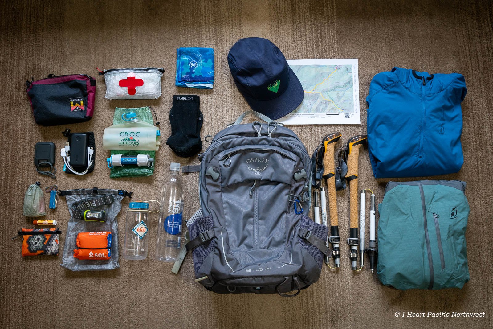
Here's a typical day-hiking gear setup including water, navigation, first aid, and sun protection.
Rattlesnake Safety: What Every Hiker Needs to Know
Rattlesnakes are a fact of life in Chino Hills State Park. They are most active from April through October but can appear year-round on warm days. I have encountered them on trails at least a dozen times over the years. Every encounter was manageable because I knew what to do.
Stay on designated trails. Rattlesnakes blend into the surrounding brush and rocks. Stepping off-trail into tall grass is how most bites happen.
Watch where you put your hands and feet. If you are stepping over a rock or log, step on top of it first, not directly over it. Snakes rest in the shade on the far side.
If you see a rattlesnake, stop, back up slowly, and give it at least six feet of clearance. They are not aggressive. They will move on if you give them room. If the snake is on the trail, wait. It will leave. Do not throw rocks, poke it with a stick, or try to go around it through the brush.
If someone is bitten, stay calm, call 911, and get to a trailhead as quickly as possible without running. Remove any rings, watches, or tight clothing near the bite because swelling starts quickly. Do not apply a tourniquet, do not try to suck out the venom, and do not ice the bite. The nearest hospitals with antivenom are St. Jude Medical Center in Fullerton and Anaheim Global Medical Center. Source: California State Parks, Chino Hills.
Which Yorba Linda Neighborhoods Have the Best Trail Access
I get asked this constantly. A family will tell me they want to hike on weekends, and I tell them that the difference between "hiking on weekends" and "stepping out your back gate onto a trail every morning before work" comes down to which street you live on. That is not an exaggeration. I will give you specific streets.
Trail access is one of the most underrated factors in Yorba Linda home values, and it is one of the first things I evaluate when matching buyers to neighborhoods.
Direct trail access (walk out your door): Homes on the 4800 and 4900 blocks of Blue Gum Drive and the upper (north) end of Rim Crest Drive in northern Yorba Linda are literally steps from the South Ridge Trail. I mean literally. There are homes on Blue Gum where you walk out your side gate and you are standing on the trail that leads to San Juan Hill. No driving. No parking lot. No $10 fee. You lace up your shoes, open your gate, and you are hiking.
Properties in the Hidden Hills Estates area along Camino De Bryant and the equestrian corridors north of Yorba Linda Boulevard also have trail connectivity, and many of those lots are a third of an acre to a full acre with equestrian zoning. Horses are not just allowed here, the infrastructure is built for them: bridle trails along the road, crossing signals, and direct connections from private arenas and stables to city trails that feed into the state park. I sold a home on Camino de Bryant in 2024 where the buyer's primary reason for choosing that lot was the connector trail visible from the backyard fence. If your family rides horses, this is one of the few places in Orange County where you can saddle up at home and ride directly into a 14,000-acre state park without loading a trailer.
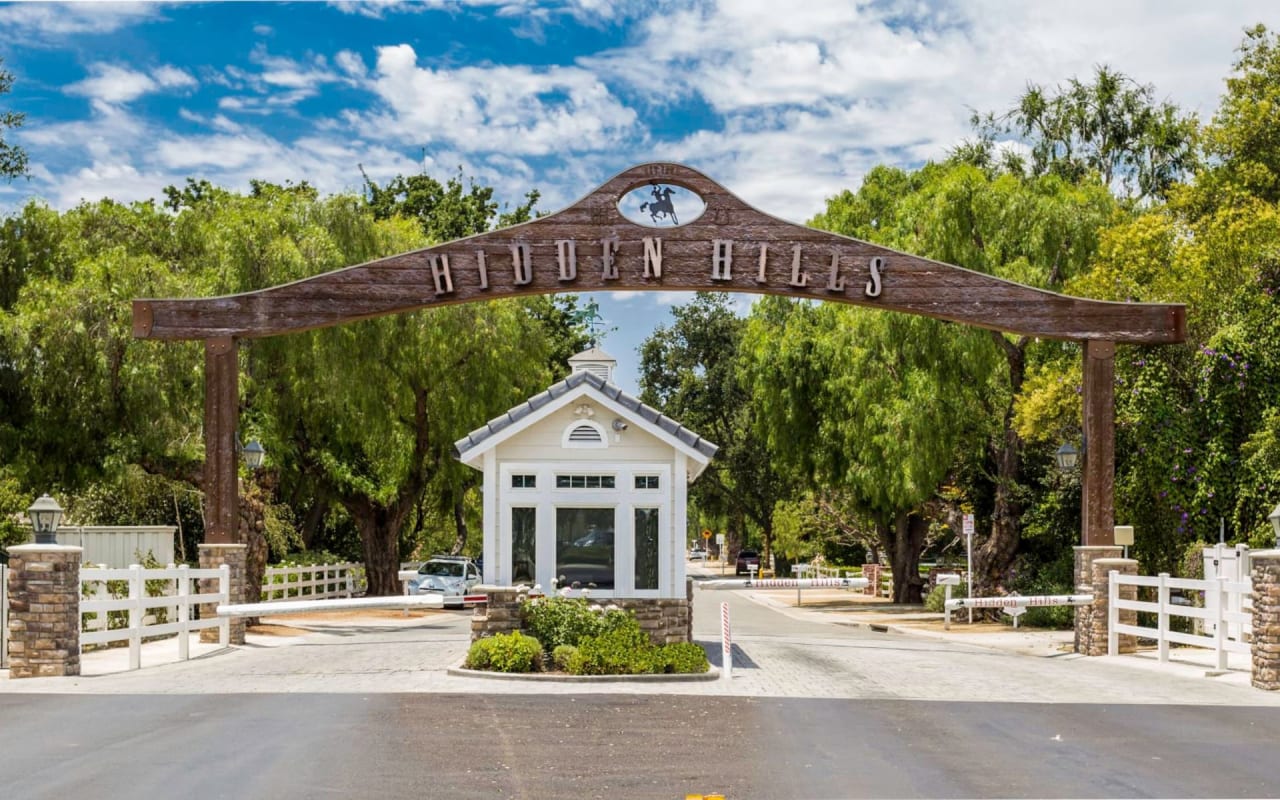
Hidden Hills in Yorba Linda is one of several neighborhoods where trail access connects directly to the Chino Hills State Park system.
Short drive or walk to a trailhead (under 5 minutes): Families in Travis Ranch, Fairmont Knolls, and Vista Del Verde are all within a quick drive or bike ride to either the Rim Crest trailhead or the Quarter Horse staging area. Travis Ranch has its own internal walking path system that runs along the community's western and northern edges and connects to the broader Yorba Linda trail network. Several homes in Brighton Estates on the streets closest to Fairmont Boulevard back to greenbelts that link to trail corridors leading north toward the park.
Here is a story that illustrates why this matters. I had a client last year debating between two homes in different parts of Yorba Linda. Both were four bedrooms, similar square footage, within $30,000 of each other in price. One was in southern Yorba Linda near Imperial Highway. The other was on the north side, about a 5-minute walk from the Quarter Horse trailhead. The family had two teenagers who mountain biked. I told them to spend one Saturday morning at each location and see which one felt like home. They chose the north side property. Those kids have ridden trails almost every weekend since. The mom told me recently that the boys' screen time dropped by half after they moved. The south-side house would have been a fine home. But it would not have been the right home for that family. That is the kind of match I try to make.
Vista Del Verde deserves a specific mention. This gated community is built around Black Gold Golf Club, but what non-residents do not realize is that it also borders open space with trail access on its northern edge. You get the golf club lifestyle and proximity to the state park. That Seattle couple I mentioned at the top of this post? They bought in Vista Del Verde specifically because their back gate opens to a connector trail that puts them on the South Ridge in under 10 minutes. They walk it three or four mornings a week now. Homes here range from $1.5 million to over $3 million. The streets along the northern perimeter, the ones backing to the open hillside, tend to command the strongest premiums because of the unobstructed views and trail proximity. Those views are protected permanently. The land is state park. It will never be developed. That is an amenity attached to your property that no future builder can take away.
Moderate drive to trailheads (10 to 15 minutes): South Yorba Linda neighborhoods below Yorba Linda Boulevard, including Lakeview and the older original residential core, are further from the state park entrances. You are looking at a 10 to 15 minute drive to Rim Crest or Quarter Horse. These homes are closer to Craig Regional Park and the Santa Ana River Trail, which offers a different kind of outdoor access: a 50-mile paved path, flat, good for road cycling, running, and stroller walks. That is a legitimate outdoor lifestyle, just a different one. Some families prefer it. If your outdoor priority is cycling or running on pavement rather than hiking dirt trails, south Yorba Linda gives you quicker access to a world-class paved trail system.
If you are relocating to Yorba Linda and outdoor access matters to your family, the neighborhood you choose determines whether you have trail access from your back gate or need to drive 10 minutes to a trailhead. I match families to neighborhoods based on lifestyle factors like this, not just bedroom count and school zone.
And if you are looking at homes in Anaheim Hills, the eastern hillside communities there also have trail connections to regional open space, including Coal Canyon which connects Chino Hills State Park to the Santa Ana Mountains. The terrain and fire risk profile is different (I wrote about that here).
For buyers interested in luxury properties in the hillside areas of Yorba Linda, the premium lots are the ones with direct trail access or unobstructed views of the open space. If you want help identifying which streets have those sight lines and which ones lost them to neighboring rooflines, that is the kind of block-by-block knowledge I bring to every buyer consultation.
Quick Reference: Chino Hills State Park Essential Info
Park Size: 14,102 acres, over 90 miles of trails across Orange, San Bernardino, and Riverside Counties.
Yorba Linda Trailheads (free parking): Rim Crest Drive at Blue Gum Drive. Quarter Horse Drive off Fairmont Blvd. Casino Ridge staging area off Hidden Hills Road.
Brea Entrance (paid): Discovery Center at 4500 Carbon Canyon Road. $10/vehicle ($9 seniors 62+). Walk-in is free.
Budget Alternative: Carbon Canyon Regional Park, $3 weekday / $5 weekend. Adjacent to Discovery Center with connecting trails.
Best Season: Late February through April. Green hills, wildflowers, cool mornings. Peak bloom typically mid-March.
Closure Policy: All dirt trails close for minimum 48 hours after 1/4 inch of rain. Park closes during Red Flag Warnings. Check parks.ca.gov/ChinoHills before every visit.
Currently Closed Trails (Feb 2026): Hills For Everyone Trail (indefinite). North Ridge Trail from Telegraph Canyon east to Gilman Trail (indefinite).
Dogs: Not allowed on any trail. Only permitted on Bane Canyon Road, Rolling M Ranch, and Discovery Center day use areas, on leash.
Drones: Prohibited in the entire park.
Speed Limit: 15 mph for all vehicles and bicycles.
Camping: Rolling M Ranch Campground, 20 sites, $30/night. Reserve at ReserveCalifornia.com or call (800) 444-7275.
Rattlesnakes: Common throughout the park, especially May through October. Stay on trails. Watch where you step and sit.
Water: Available at the Discovery Center, Rolling M Ranch, and the Equestrian Staging area. NOT available at Rim Crest, Quarter Horse, or Casino Ridge trailheads. Always bring your own.
Park Phone: (951) 780-6222. Call to verify trail conditions before driving.
Emergency: Call 911. Nearest hospitals with antivenom: St. Jude Medical Center (Fullerton) and Anaheim Global Medical Center. Cell service is unreliable in canyon areas.
Frequently Asked Questions
What is the best hiking trail near Yorba Linda for beginners?
The Carbon Canyon Nature Trail in Carbon Canyon Regional Park is the best beginner trail near Yorba Linda. It is a 3.1-mile loop with only 104 feet of elevation gain, well-maintained paths, restroom access, and it leads to Orange County's only coastal redwood grove. Parking costs $3 on weekdays and $5 on weekends. Dogs are allowed on leash. For a slightly more challenging but still manageable option, the Little Canyon Loop from the Rim Crest Drive trailhead in Chino Hills State Park is about 4.5 miles with roughly 400 feet of elevation gain.
Can I bring my dog hiking in Chino Hills State Park?
No. Dogs are not allowed on any trail in Chino Hills State Park. They are only permitted on Bane Canyon Road (paved), at the Rolling M Ranch day use area and campground, and at the Discovery Center day use areas. They must be on leash at all times. If you want to hike with your dog near Yorba Linda, Carbon Canyon Regional Park allows leashed dogs on its trails.
How do I get to Chino Hills State Park from Yorba Linda?
Yorba Linda has three free access points to Chino Hills State Park. The Rim Crest Drive trailhead (at Blue Gum Drive) puts you directly on the South Ridge Trail. The Quarter Horse Drive trailhead (off Fairmont Blvd) connects via the Fairmont Staging Trail. The Casino Ridge staging area accesses the eastern section of the park. You can also enter from the Discovery Center in Brea at 4500 Carbon Canyon Road for a $10 parking fee.
What is the highest point in Chino Hills State Park?
San Juan Hill at 1,781 feet is the highest point in Chino Hills State Park. It is accessible via the South Ridge Trail from the Rim Crest Drive trailhead in Yorba Linda. The out-and-back hike is 6.1 miles with 1,046 feet of elevation gain and takes 3 to 3.5 hours. The summit has a concrete monument from 1896 and 360-degree panoramic views.
Are trails in Chino Hills State Park open after rain?
No. All dirt trails close for a minimum of 48 hours after any rainfall of one quarter inch or more. The high clay content in the soil makes trails dangerously slick and prone to erosion when wet. The park also closes during Red Flag fire warnings. Check trail status at parks.ca.gov/ChinoHills before visiting.
Is there a free way to access Chino Hills State Park?
Yes. All three Yorba Linda trailheads (Rim Crest Drive, Quarter Horse Drive, and Casino Ridge) offer free parking and free entry into the park. The only paid entrance is the Discovery Center on Carbon Canyon Road in Brea, which charges $10 per vehicle. Walk-in access at any entrance is free.
When is the best time of year to hike in Chino Hills State Park?
Late February through April offers the best combination of mild temperatures, green hills, and wildflower blooms. The mustard bloom typically peaks in mid-March. Summer hiking (July through October) is possible but requires early starts due to heat and sun exposure on the shadeless ridgeline trails. Winter (November through January) offers mild weather and solitude between rain closures.
Are there rattlesnakes on the trails in Chino Hills State Park?
Yes. Rattlesnakes are common throughout the park, especially from April through October. Stay on designated trails, watch where you step and place your hands, and give any snake at least six feet of clearance. If bitten, call 911 and get to a trailhead as quickly as possible. Do not apply a tourniquet or attempt to suck out venom. The nearest hospitals with antivenom are St. Jude Medical Center in Fullerton and Anaheim Global Medical Center.
Where can I hike near Yorba Linda when Chino Hills State Park is closed?
When the state park closes for rain or fire danger, your best alternatives are Carbon Canyon Regional Park in Brea (3.1-mile nature trail, stays open after rain, dog-friendly, $3-5 parking), Yorba Regional Park along the Santa Ana River (flat paved and dirt paths), and Oak Canyon Nature Center in Anaheim Hills (4 miles of shaded trails through oak woodlands, free admission). The paved portions of Yorba Linda's community trail system also remain accessible year-round.
Sources
-
California State Parks, Chino Hills State Park main page. parks.ca.gov
-
California State Parks, Chino Hills Recreation and Trails. parks.ca.gov
-
California State Parks, Chino Hills closure notices. parks.ca.gov
-
City of Yorba Linda, Trails page. yorbalindaca.gov
-
City of Yorba Linda, Quarter Horse Staging Area. yorbalindaca.gov
-
City of Chino Hills, State Park page. chinohills.org
-
CHSP Interpretive Association, Hiking Guide. chinohillsstatepark.org
-
OC Parks, Carbon Canyon Regional Park. ocparks.com
-
AllTrails, San Juan Hill via South Ridge Trail. alltrails.com
-
AllTrails, San Juan Hill Loop. alltrails.com
-
AllTrails, Carbon Canyon Nature Trail. alltrails.com
-
AllTrails, Telegraph Canyon Road. alltrails.com
-
Modern Hiker, San Juan Hill in Chino Hills State Park. modernhiker.com
-
Hills For Everyone, Quarterhorse trailhead. hillsforeveryone.org
-
California State Parks, Spring Wildflowers at Chino Hills. parks.ca.gov